how to create step by step the creation of handmade tanned leather handbags.
Latest posts
-
 How to make a handmade leather bag step by step?Read more
 -
 Types of leather What kind of leather do we use for each product?Read more
Are you interested in the types of leather we use to make our product? Visit our blog and read about the creation of...
-
 Tips to care for your leather productsRead more
The leather or tanned leather is a natural and organic material with excellent attributes of resistance and...
-
 5 Steps to identify Synthetic LeatherRead more
Commercially speaking, leatherwork has been divided in two different groups: natural leather and synthetic leather or...
-
 Vegetable Leather DyeingRead more
In this article, we want to show how to dye leather by hand, and the types of dyes we use to color leather and obtain...
-
 A little Story of the Seal of CordovaRead more
History of the official Seal and Coat of arms of Cordova since 13th century trough Meryan leather workshop
-
 Discover Najima backpack, the leather laptop backpack from Laceria Collection.Read more
New embossed leather laptop bakpack for men. It is an unique and exclusive item made by cordovan style.
-
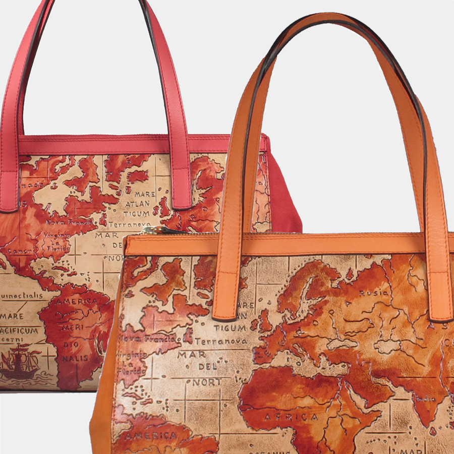
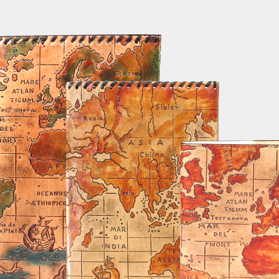
 World Maps: a window to our history engraved in leatherRead more
The relevant history of maps and how they change our view of the world. Their influence in our leather handbags...
-
 The Mezquita Bag Collection by cordovan style.Read more
The bag collection has an out-of-time where you can behold the excellent quality of Meryan´s leatherwork.
-
 Meryan and Promi FoundationRead more
Meryan cooperates since last year with Promi Foundation, working with people with special needs.
Blog categories
Search in blog

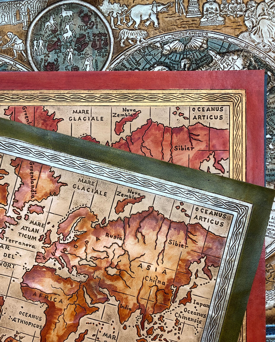
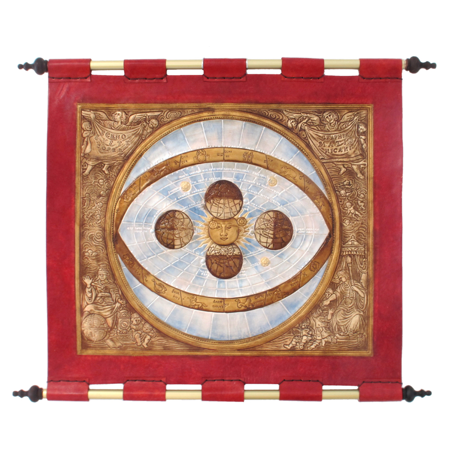
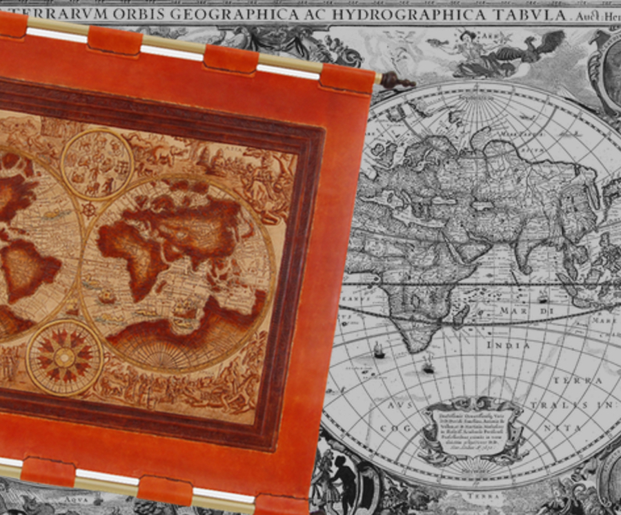
World Maps: a window to our history engraved in leather
The Man is a tireless wayfarer... since its inception people felt the urge to know and understand their environment, explore it and expand their horizons as well as maintain and pass this knowledge on to the future generations.
Initially, in Prehistoric times, they depicted schematic lines in rocks with the main landmarks for the best hunting areas. It was the way to ensure the subsistence. Later on in many different and remote civilizations as the Egyptian, the Babylonian or pre-Columbian, all those simple lines and diagrams in rocks became more complex representing real and imaginary places mixed together using fabrics, fur or papyrus to “print it on”. Thousand years later, the maps became in real maritime and trade routes handbooks or furthermore, clear references to new places to conquer.
Always go beyond the known, transforming the herculean idea of “Non terrae plus ultra” (there is no land beyond) into the searching of new paths even beyond the stars.
But the origins of cartography and mapping as it is today are in Ancient Greece, then they used a method closer to a scientific one. They depicted a spherical Earth, more realistic even using meridians. Prominent personalities such as Ptolomeo were the references for more recent cartographers.
We understand the world maps not only as an art but also as a valuable witness of human evolution and its worldview and cosmogony. The world maps depicted the real known world and its geographical features but also represented allegories figures, constellations, gods and fantastic creatures. After all… they show us the searching for our cosmic origen, the Human existence itself, the representation of light (the known world) and darkness (the unknown world).
So that, we considered the beautiful idea of discovering our own world through the history of cartography, contemplate how new countries and new continents “arise” in front of our eyes thank to the maps depicted by sailors centuries ago.
We selected for our workshop Jan Baptista Vrients’s world map, that showed for first time Korea in 1595. We decided to enrich and reinterpret his map from five centuries ago by adding more recent monuments.
Our workshop also replicate Kaerius’s Atlas, he was a cartographer in 17th century. His Atlas was named as “The Theatre of The World” and it was a 53 maps compiled by Ortelius but created by different navigators through the centuries.
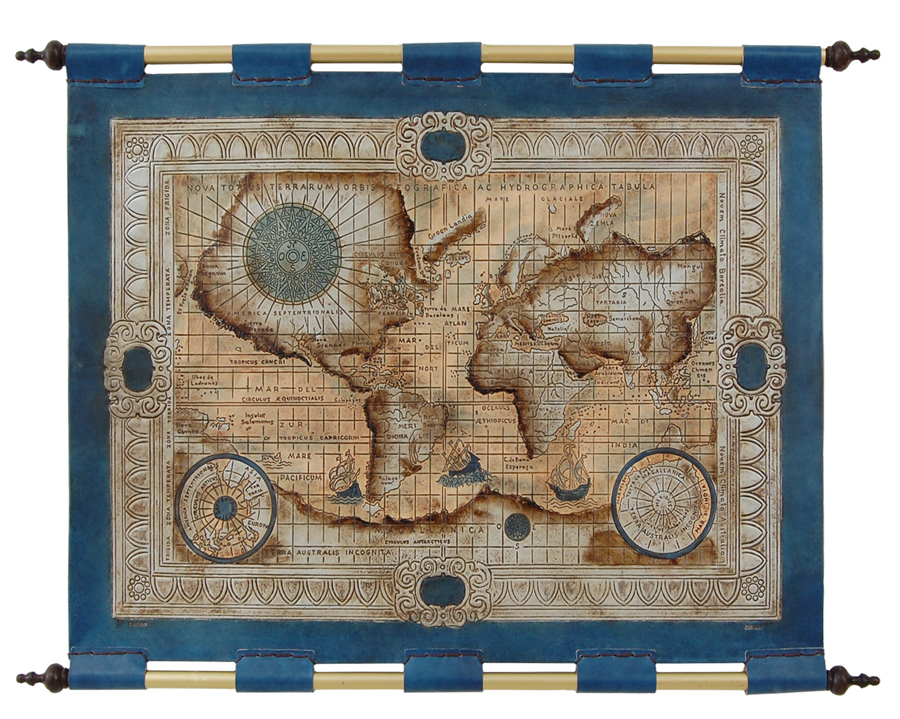
It was for us a lovely and challenging task to capture all the beauty of The Earth through the eyes of the former cartographers. Tapestries, jewel cases, covers and a new handbags collection inspired by the humankind’s relentless pursuit of new beginnings and new paths...
Posted in:
Home decoration
Related posts
-
 Arrayán the subtle beauty
Every year in mid-june the Hispanic-Arabian garden flourished in white flowers of Arrayán at Madinat- Al-Zahra and...Read more
Arrayán the subtle beauty
Every year in mid-june the Hispanic-Arabian garden flourished in white flowers of Arrayán at Madinat- Al-Zahra and...Read more -
 Iris , Design with a History
Iris , takes its name from the decorative motives of this flower that is displayed the Great Mosque of Cordova and...Read more
Iris , Design with a History
Iris , takes its name from the decorative motives of this flower that is displayed the Great Mosque of Cordova and...Read more -
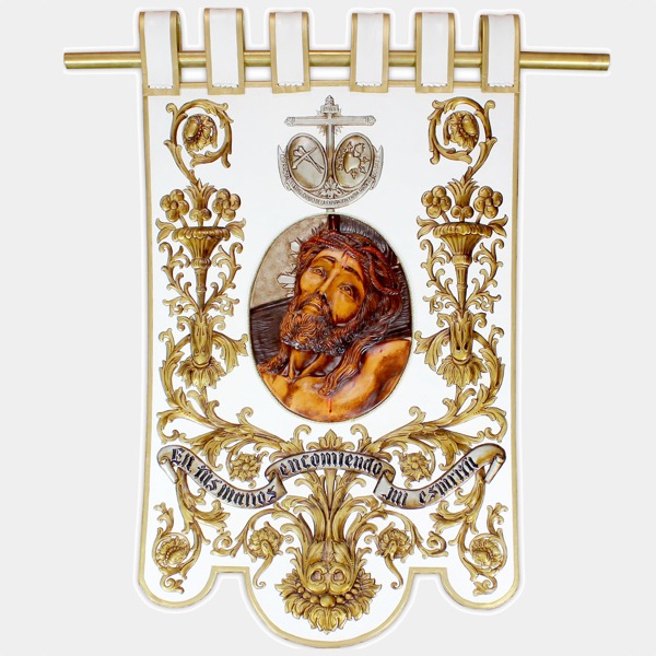 Estandarte de Semana Santa para una cofradía de Daimiel
Recientemente hemos elaborado un estandarte para la Cofradía del Santísimo Cristo de la Expiración y Nuestra Señora...Read more
Estandarte de Semana Santa para una cofradía de Daimiel
Recientemente hemos elaborado un estandarte para la Cofradía del Santísimo Cristo de la Expiración y Nuestra Señora...Read more
Leave a comment